Kancamagus Highway Day Trip: Stops and Road Plan
How should you plan a Kancamagus Highway day trip?
Plan a Kancamagus Highway day trip as a half-day scenic drive between Conway and Lincoln, not a race across Route 112. Choose three or four official stops, fuel up before entering the byway, download directions, and check weather plus White Mountain National Forest alerts on departure morning. Allow extra time in foliage season and turn around if road, weather, or parking conditions make the plan unsuitable.
The road earns its reputation through forest, river, and mountain views. It also becomes much less charming when every pull-off is treated as mandatory homework.
Pick a direction and a short stop list
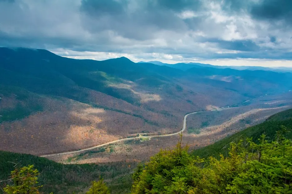
The U.S. Forest Service describes the Kancamagus Scenic Byway as a 34-mile route through the White Mountain National Forest. You can begin in Conway and drive west toward Lincoln, or reverse the order. Pick the direction that suits your lodging and daylight rather than chasing a supposedly perfect sequence.
For a simple east-to-west plan, choose:
- Albany Covered Bridge for a first leg-stretch and river setting.
- Rocky Gorge Scenic Area for a managed viewpoint and interpretive stop.
- Sabbaday Falls for a short walk rather than a full hike.
- One signed overlook near the western side, only if parking is available.
The Forest Service's Sabbaday Falls listing describes an evenly graded gravel approach from a paved parking lot, followed by a stone staircase and gravel walkway beside the falls. That is useful planning information, but it is not a guarantee that every visitor can use the full route. Current surface, stair, weather, and maintenance conditions matter.
Prepare before Route 112 narrows your options
New Hampshire's official Kancamagus travel guide says the 34.5-mile stretch has no gas stations and minimal to no cell service. Fill the tank in Conway or Lincoln, download the route, and bring water, food, layers, and any medicines you may need. Some managed recreation stops charge a fee, so check the Forest Service's current pass information rather than assuming a pass or price.
Check the White Mountain National Forest alerts and New England 511 immediately before departure. Seasonal closures and temporary restrictions can change access. A saved itinerary does not override a gate, sign, alert, or road closure.
Stop only in designated parking areas
Use signed pull-offs and recreation-site parking. If a lot is full, continue to the next safe, legal stop. Do not stop in a travel lane, park on an unsigned shoulder, or walk along the roadway for a photograph. The state travel guide explicitly warns against roadside parking.
At waterfalls and river edges, remain behind barriers and on the maintained route. Wet rock, high water, ice, and fast current are hazards. Do not enter the water or climb on rock for a better angle. Keep children within direct reach near water and traffic.
Fog, heavy rain, ice, snow, leaf litter, and early darkness can change braking distance and visibility. Slow to the posted limit or below it when conditions require, use headlights as required, and leave enough distance to stop. If the road becomes unsafe, use the next safe legal place to turn around or continue to an open endpoint; do not make a sudden U-turn in the roadway.
Budget time for the stops, not just the miles
Without stops, the route can look brief on a map. With parking, short walks, photographs, and foliage traffic, it can fill much of a day. Start early, but do not promise yourself sunrise at one end and sunset at the other. One clear overlook is worth more than five blurred views through a windscreen.
Pack lunch or plan to eat at an endpoint. There are no roadside restaurants in the forest stretch, and picnicking should happen only where it is allowed. Carry out all rubbish and follow current food-storage or wildlife instructions posted by the Forest Service.
If mountains are not in the mood, switch to the Lake Winnipesaukee day-trip plan and check its park conditions first. Find more routes in Scenic Roads.
Sources
- U.S. Forest Service — White Mountain National Forest Scenic Drives — Kancamagus Scenic Byway identity, setting, and official route length.
- U.S. Forest Service — Sabbaday Falls Observation Site listing — approach surface, parking, stairs, and walkway description.
- U.S. Forest Service — White Mountain National Forest Alerts — current closure, restriction, and forest-road status route.
- Visit New Hampshire — Ultimate NH Fall Foliage Road Trip Guide — fuel, cell-service, parking, fee, and seasonal traffic planning.
- New England 511 — current official road-condition check.